Bogotá
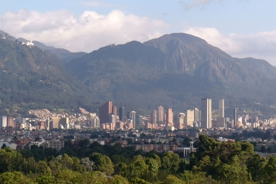
Colombia's capital and largest city, home to more than seven million people, sits on a high Andean plateau at 2,640 metres (8,660 ft), with mild days, cool nights and green hills in view from almost every street.

Three things to know before you pack
- It is cool, all year. Bogotá is just north of the equator but high in the Andes. Expect about 19 °C (66 °F) by day and 8 °C (46 °F) at night, in July as in any other month. See weather and altitude.
- It is high. At 2,640 m (8,660 ft), most visitors notice the altitude on the first day or two. Taking it easy on arrival helps.
- The sun is strong. Even on a cloudy day, sunscreen is part of the daily routine here.
The city
Founded in 1538, Bogotá is Colombia’s capital and largest city, with more than seven million inhabitants and over ten million in the metropolitan area. It stretches along a high plateau at the foot of the Cerros Orientales, the eastern hills, which are visible from almost everywhere and make it easy to find your bearings: the hills are always to the east.
The congress takes place in the north of the city, in the Chicó area near Parque de la 93 (see venue). The historic centre, La Candelaria, is about ten kilometres (6.2 mi) to the south.

Finding your way
The city is laid out on a grid. Calles run east to west, and their numbers go up as you travel north. Carreras run north to south, and their numbers go up as you move west, away from the hills. An address such as “Calle 85 # 12-30” means a building on Calle 85, thirty metres (about 100 ft) from the corner of Carrera 12.
At a glance
| Altitude | 2,640 m (8,660 ft) |
| Temperature | 6 to 19 °C (43 to 66 °F) all year, 14.5 °C (58 °F) on average |
| Daylight | About 12 hours all year, dark shortly after 6 pm |
| Time zone | UTC−5, no daylight saving time |
| Language | Spanish |
| Currency | Colombian peso (COP) |
| Electricity | 110 V, 60 Hz, plug types A and B |
| Airport | El Dorado International (BOG) |
Last updated